We have a new paper out in IEEE Transactions on Geoscience and Remote Sensing (TGARS) entitled: “3D terrain mapping and filtering from coarse resolution data cubes extracted from real-aperture 94 GHz radar”. Link here: https://ieeexplore.ieee.org/document/10398270
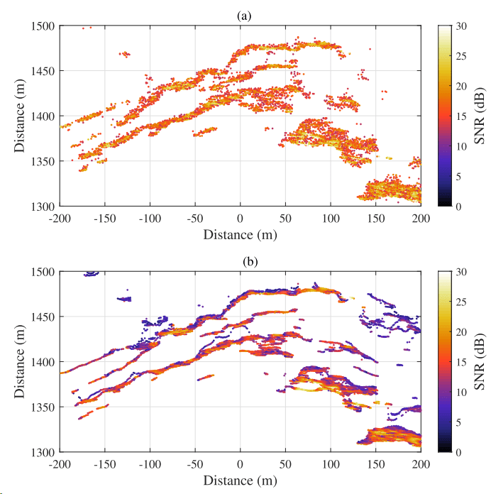
We developed a new workflow to extract point clouds from 3D data cubes acquired using 94 GHz radar, specifically that of the AVTIS radar (details on the radar system here). The new workflow consists of spatially averaging waveforms (range profiles) to increase SNR, extracting multiple points along a waveform and filtering based on SNR and Voronoi diagrams. Figure 1 shows an example of the improvement in SNR resulting from this new technique.

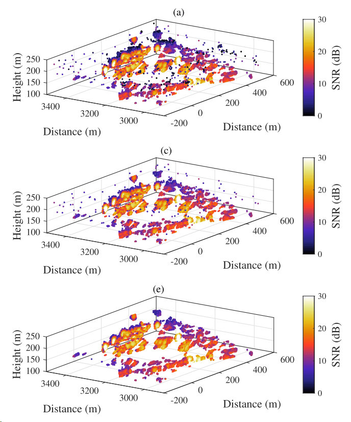
We also developed a point cloud filtering process by first removing low SNR points following an automated interrogation of the SNR histogram. Then, we use Voronoi diagrams to locate point cloud outliers automatically and remove them. An example of the filtered point cloud process is shown in Figure 2.
The resulting point cloud is more ‘stable’ in that we can repeat the result over stable terrain AND reduce point cloud uncertainty. The affect of waveform averaging is particularly noticeable in Figure 3, where the spread of points becomes smaller.
The paper is a detailed study of the accuracy of point clouds extracted from 94 GHz radar data, specifically AVTIS2. With the new algorithm, point cloud uncertainties are ~1.5 m at 1.5 km, and ~3 m at 3 km (handy numbers!). We hope to upload the code to Github in due course.
