Small and Micro Satellites
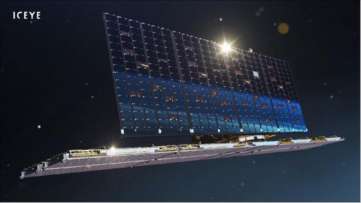
Recent developments and miniaturisation of sensor technology have brough about the launch of large constellations capable of mapping the entire globe every day at high resolution (below 5 m). Examples include both Synthetic Aperture Radar (SAR) (e.g. ICEYE, Umbra, Capella) and optical (e.g. Planet, WorldView) satellites. We harness these game-changing technologies to study highly dynamic systems that require high spatio-temporal resolution measurements. Examples include studying glacier surge processes, ice melange dynamics, and ice surface conditions.
Satellite Remote Sensing
We utilise Earth Observation data sets from a range of platforms (satellites, ground-based and aerial) and sensors (e.g. radar, optical, altimeters) to study glaciers, ice sheets & snow-covered terrain. We focus on developing data products on small and large scales in order to understand cryospheric processes such as glacier dynamics, iceberg calving and snow hazards. We also develop methodologies and techniques to improve satellite data processing and analysis to improve the accuracy of the resultant data products. We apply our work across the Arctic and primarily in Greenland, Svalbard and the Canadian Arctic.
Earth Observation Databases
Will Harcourt works in organisations such as the Svalbard Integrated Arctic Earth Observing System (SIOS) and the Association for Polar Early Career Scientists (APECS). His contributions include the development of Earth Observation tools to improve the accessibility of remote sensing data for Polar scientists. Will has led the development of the APECS Polar Earth Observation database which includes a comprehensive survey of satellites, sensors and data products used in the Polar regions. This project is aimed at improving knowledge of satellite remote sensing data for Polar research. In His role in SIOS, he further developed Earth Observation databases and tools specifically targeted at Svalbard researchers.

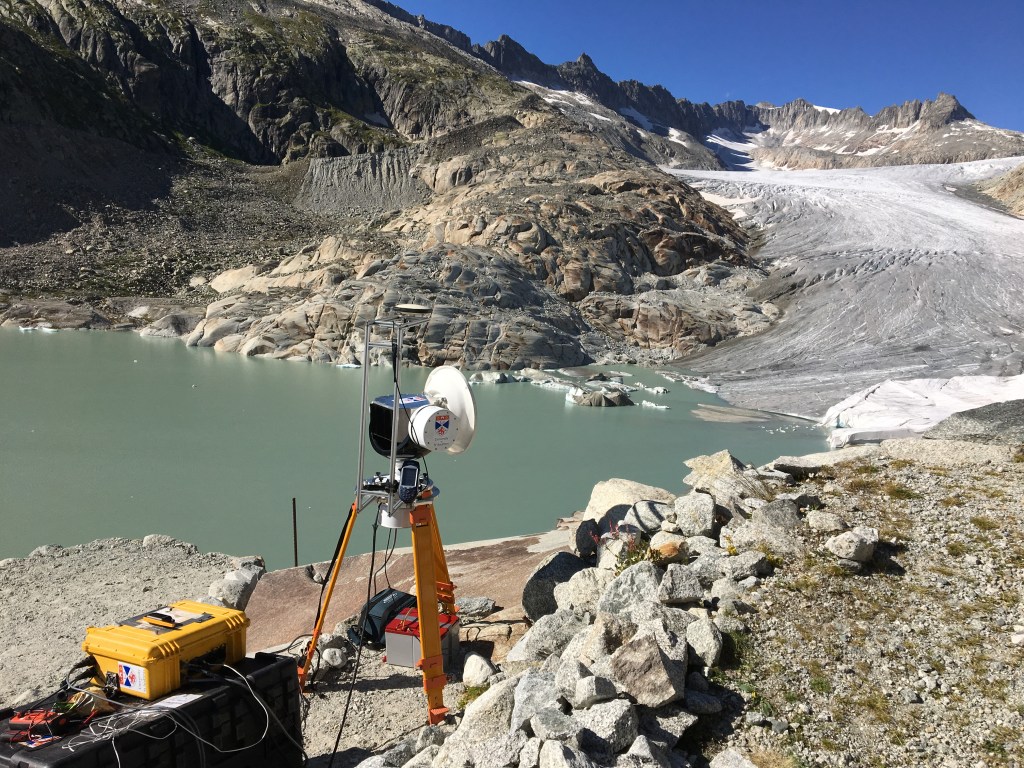
Millimetre-wave Radar
Will Harcourt’s PhD developed the capabilities of using millimetre-wave radar at 94 GHz for mapping and monitoring the cryosphere. Millimetre-wave radar offers a trade-off between imaging resolution and operation during adverse weather conditions, hence it can acquire an almost continuous time series of glacier change even in conditions of reduced visibility. I developed the AVTIS2 system (All-weather Volcano Topography Imaging Sensor) developed at the University of St Andrews for this purpose. In this project, we developed new processing and analysis tools to analyse 94 GHz radar backscatter and extract 3D point clouds from the data cube. We demonstrated its performance in mapping snow covered terrain and quantifying calving rates at a tidewater glacier in Svalbard. We are now continuing to develop the tool in wider cryospheric applications.